El Diario reports:
Virtual visits
An application is prepared to see archaeological sites
• The donation made by the Government of Belgium makes possible this technological advance in favor of the national culture
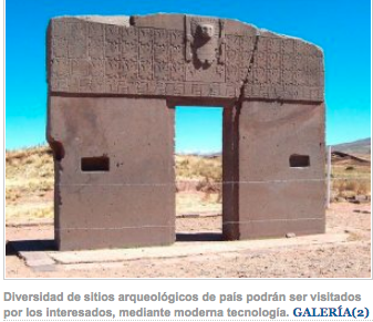 The application of a state-of-the-art technology will allow visitors to walk through archaeological sites in three dimensions through virtual visits, thereby saving time and economic resources for those who want to know those ancestral sites, said archaeologist José Luis Paz, chief of the Unit of Archeology and Museums of the Ministry of Cultures.
ADVANCE
The technology applied on the basis of state-of-the-art equipment donated by the Government of Belgium, has already processed 70% the archaeological site of Incallajta de Cochabamba, a place that can be seen in three dimensions in virtual visits.
According to the report of the head of the Unit of Archeology and Museums, the equipment that was donated and that will allow to register and process the archaeological sites that are constituted in national patrimonies, are integrated by a drone with professional camera, theodolite and laser scanner. All the donated equipment has a value of 52 thousand euros (443 thousand bolivianos), besides the Belgian Cooperation also grants the technical support in the handling of the equipment through an expert.
This technology is also part of the National Registry Program that aims to regularize all the archaeological sites and others that are constituted in national patrimonies.
MILLIMETRIC RECORDS
According to the report of the archaeologist Paz, the equipment will allow to execute millimeter records of the archaeological sites, which will require the diagnosis and will serve as the base to execute the conservation, since it will allow to make a survey of the situation of the walls and to detect cracks in order to proceed to its restoration.
Finally, it was also established that apart from the preparation of the virtual visits, virtual games will be enabled to reinforce the knowledge of the archaeological sites, so this technology will have different applications besides the preservation and conservation of the Bolivian heritage.
INCALLAJTA
The mapping is done using 3D Laser Scanner technology, through the emission of laser light signals that register the dimension of the structures in a millimetric way, these are reconstructed digitally by means of a specialized software that allows to appreciate the grandiosity of said structures.
Also, there is a drone whose function is to take aerial shots, this mapping allows to plan the restoration work and estimate costs for the aforementioned archaeological complex.
Incallajta was the most important Inca city of Kollasuyo, one of the four of Tahuantinsuyo. It is currently the most important Inca legacy in Bolivian territory and is located at an altitude of 2,950 meters above sea level in the department of Cochabamba being a military fortress, political, administrative and ceremonial center of the Inca Empire or Tahuantinsuyo and geographical frontier of that civilization against invasions of the Chiriguanos, according to information from the Ministry of Cultures.
