Mongabay:
by Nelfi Fernández Reyes on 6 March 2024 | Translated by Hayley Smith
- Curichi Las Garzas is a natural refuge where thousands of wood storks (Mycteria americana) arrive each year to reproduce before continuing their journey.
- Land grabbers have destroyed 300 of the protected area’s 1,247 hectares in the municipality of San Carlos, planting rice and soybean crops.
- The encroachers claim to have endorsement from the INRA (Bolivia’s National Institute of Agrarian Reform), but the INRA has denied this and has asked the mayor to intervene. In the last three months, more than 4,500 deforestation alerts have been recorded along with a peak of 42 fire alerts, the highest number for the last 10 years.
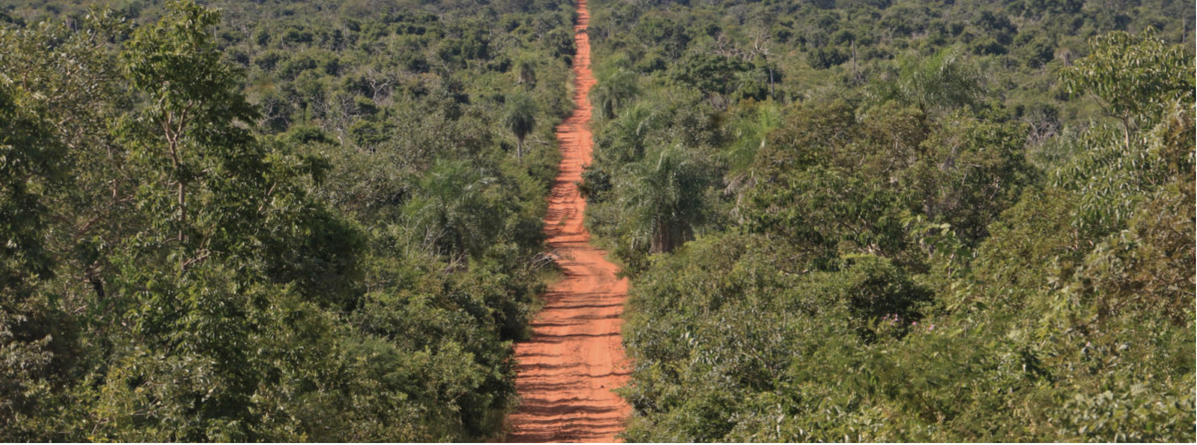
Regardless of what satellite images show, inhabitants who have illegally planted crops within the protected area told committee officials that they “take care of Curichi”, because each union member’s rice plots do not exceed three hectares. Behind their crops, a row of trees is visible in the background.
So, on approaching the area, the officials were understandably surprised to discover that more crops lay behind the trees.
The Global Forest Watch (GFW) satellite monitoring platform confirms this loss of forest cover. Images show that some 5,005 deforestation alerts were recorded between August 2022 and November 2023. Vitally, 4,558 of that total were generated between October and November 2023 alone. Each deforestation alert represents a loss of 30×30 meters of tropical forest, equivalent to the size of a basketball court.
These figures disprove what agricultural union members told officials, saying “this has been going on for 20 years.”
Active fire alerts picked up by VIIRS, NASA’s monitoring technology, also reveal that 42 hot spots were recorded between September and November 2023, the highest number for a decade.
Fire is often used to clear land in preparation for planting crops.
Councilwoman Mónica Vaca Gil, one of the committee members, was shocked by the extent of the damage. She says that she had tried to inspect the reserve in 2021, but was unable to complete her visit because the invaders took the local guide hostage and repeatedly assaulted him, eventually breaking his nose. On that occasion, she says, together with four other council members and Natura Foundation, they were able to reach the stork nests. At that time some virgin forest remained, and reports of encroachment and deforestation only made reference to a small cultivation plots.

Getting around the laws
Union representatives were asked if they had known that their crops were located in a municipal reserve and whether they had documents proving ownership of the occupied land. They confirmed they knew it was a protected area, but claimed that they had permission from the INRA (Bolivia’s National Institute of Agrarian Reform) and the agreement of Mayor Óscar Zinko, who came to the municipal seat with the support of the Movement Toward Socialism party (known by its Spanish acronym, MAS).
When asked about the recurrent fires, the group were quick to say that they see to it that the fires do not get out of control, with one woman claiming “We prevent the fire from going any further. We fight the fire with our lives.”
In October, fire destroyed around 300 hectares of the reserve, according to estimates by Blanca Nieves Suárez, an environmental expert with Natura Foundation. An analysis of satellite images carried out by the journalistic alliance also confirms that the recent damage is at least 300 hectares, and could even be up to 400 hectares.
But what happens after the fire is put out? Based on vague information provided by the encroachers, it seems that that’s when machinery is brought in, and then planting begins. And so, explains Blanca Nieves, agricultural activity in the area increases year on year.

“There are now 300 new hectares being used for agriculture. This is concerning because, from what we have seen during this inspection, they are continuing to burn the area with a view to creating more new hectares. They even want to apportion out the reserve,” says Suárez.
Suárez warns that, if this pattern continues, not only will the district of Antofagasta run out of water, but the entire San Carlos municipality. “It is possible to grow crops, but it will mean no water for the actual production, or for people to drink,” she says.
Walter Menacho, a legal advisor for the ABT, Bolivia’s Forest and Land Authority, accompanied the group of officials. Menacho says that the ABT took disciplinary action following the fire in October, and investigations found four people responsible, who were subjected to abbreviated proceedings and received an administrative sanction by way of a fine. Menacho did not specify the amount of the fine, although currently the official figure is 20 cents per hectare burned. The government is currently pushing for this to be increased to $20 per affected hectare.

Who is to blame?
But just who is to blame for the situation at the reserve, which is intended to protect wildlife, regulate the climate, and provide a water supply? Committee members that visited the area are pointing the finger at the San Carlos local government, the INRA, and ABT.
Eulogio Núñez, the INRA’s National Director, told El Deber and Mongabay Latam that the “Curichi Las Garzas Municipal Wildlife Reserve is unavailable public land,” and that his organization “did not authorize any settlements. Should anyone say otherwise, they should provide their authorization, as the INRA completed the area’s land titling in 2014.”
Núñez says the responsibility sits with the San Carlos Mayor’s Office. “If illegal settlements exist, the municipal government must report them to the agro-environmental court. If illegal land clearing has taken place, the municipal government must report it to the ABT,” he explains.
He goes on to say that Law 477 sets out jail sentences of 3 to 8 years for land grabbers and land traffickers. “And if any public body (that make up the four “organs” of Bolivia’s public power) is involved, the penalty is increased by 30%.”

When we contacted Mayor Óscar Sinko by telephone, he asked, “But what more do you want to know? I think it is up to the competent authority to look into the matter.”
Mayor Sinko believes it is up to community members to report the land grabbers, “giving their full names”, because “we (the Mayor’s office) are not going to go looking for them or run around after them. It is not up to us to do that.”
When asked why he had allowed agricultural activity to destroy legally protected patuju plants, junco reeds and any of the reserve’s other trees, and when there are ecotourism projects attracting visitors to Buen Retiro (a neighboring district of Antofagasta), he responded: “Listen; these stories are just stories.”
As for the ‘go-ahead’ he allegedly gave for the encroachers to enter the area with machinery, Sinko said that he is not a park ranger and cannot be “aware of everything”. “Those people who, regrettably, entered the area know the rules. So, they simply have to abide by the consequences.” With this, he abruptly ended our call.

However, Gonzalo Colque, a researcher with Fundación Tierra, explains that neither the INRA nor the San Carlos municipal government can shirk their responsibility. What is happening in El Curichi Las Garzas is not unique to this municipality, nor is it the only protected area in Bolivia that has experienced encroachment.
Colque says that land titling without evicting encroachers is causing problems in Bolivia. “When titles are granted and the regularization process is completed, the INRA is obligated to evict all illegal settlements. This is part of its responsibilities, and it can even make use of law enforcement to protect these areas of public property.”
In the case of the Municipality of San Carlos, declaring an area as a reserve “does not only buy rights, but also obligations to protect that area. And those obligations imply a municipal budget for the management, conservation, and improvement of these areas,” he says.

While local government officials continue to pass the buck, the encroachers – as one of them explained – have turned the reserve, where thousands of storks arrive every year to nest, “into a sieve”.
Now, the chicks, whose mothers were the last to arrive at Curichi and who were not affected by the huge fire in October, are preparing to leave. “What will they find next year when they return?” asks scientist Huáscar Castillo. He adds that the people of San Carlos should be aware that the Curichi reserve is not only a haven for wildlife and a breeding ground for the storks, but also functions as an ecosystem that regulates the climate and temperature, as well as the water they themselves consume.
por Nelfi Fernández Reyes el 6 Marzo 2024 | Traducido por Hayley Smith
- Curichi Las Garzas es un refugio natural donde miles de cigüeñas de madera (Mycteria americana) llegan cada año para reproducirse antes de continuar su viaje.
- Los usurpadores de tierras han destruido 300 de las 1.247 hectáreas de la zona protegida en el municipio de San Carlos, plantando cultivos de arroz y soya.
- Los invasores afirman tener respaldo del INRA (Instituto Nacional de Reforma Agraria de Bolivia), pero el INRA ha negado esto y ha pedido al alcalde que intervenga. En los últimos tres meses, se han registrado más de 4.500 alertas de deforestación junto con un pico de 42 alertas de incendios, la cifra más alta en los últimos 10 años.
Independientemente de lo que muestren las imágenes satelitales, los habitantes que han plantado cultivos ilegalmente dentro de la zona protegida dijeron a los funcionarios del comité que “cuidan del Curichi”, porque las parcelas de arroz de cada miembro del sindicato no superan las tres hectáreas. Detrás de sus cultivos, se puede ver una fila de árboles en el fondo.
Entonces, al acercarse a la zona, los funcionarios se sorprendieron al descubrir que había más cultivos detrás de los árboles.
La plataforma de monitoreo satelital Global Forest Watch (GFW) confirma esta pérdida de cobertura forestal. Las imágenes muestran que se registraron unas 5.005 alertas de deforestación entre agosto de 2022 y noviembre de 2023. Es vital destacar que 4.558 de ese total se generaron entre octubre y noviembre de 2023 solamente. Cada alerta de deforestación representa una pérdida de 30×30 metros de bosque tropical, equivalente al tamaño de una cancha de baloncesto.
Estas cifras desmienten lo que los miembros del sindicato agrícola dijeron a los funcionarios, afirmando “esto ha estado ocurriendo durante 20 años”.
Las alertas activas de incendios detectadas por VIIRS, la tecnología de monitoreo de la NASA, también revelan que se registraron 42 puntos calientes entre septiembre y noviembre de 2023, la cifra más alta en una década.
El fuego se utiliza a menudo para limpiar la tierra en preparación para sembrar cultivos.
La concejala Mónica Vaca Gil, una de los miembros del comité, quedó impactada por la magnitud del daño. Ella afirma que intentó inspeccionar la reserva en 2021, pero no pudo completar su visita porque los invasores tomaron como rehén al guía local y lo agredieron repetidamente, rompiéndole finalmente la nariz. En esa ocasión, dice, junto con otros cuatro miembros del concejo y la Fundación Natura, lograron llegar a los nidos de las cigüeñas. En ese momento, aún quedaba algo de bosque virgen, y los informes sobre invasiones y deforestación solo hacían referencia a pequeñas parcelas de cultivo.
Evitando las leyes
Se les preguntó a los representantes del sindicato si sabían que sus cultivos estaban ubicados en una reserva municipal y si tenían documentos que demostraran la propiedad de la tierra ocupada. Confirmaron que sabían que era un área protegida, pero afirmaron que tenían permiso del INRA (Instituto Nacional de Reforma Agraria de Bolivia) y el acuerdo del alcalde Óscar Zinko, quien llegó a la alcaldía con el apoyo del Movimiento Al Socialismo (MAS).
Cuando se les preguntó sobre los incendios recurrentes, el grupo rápidamente dijo que se aseguran de que los incendios no se salgan de control, con una mujer afirmando: “Evitamos que el fuego se propague. Luchamos contra el fuego con nuestras vidas”.
En octubre, el fuego destruyó alrededor de 300 hectáreas de la reserva, según estimaciones de Blanca Nieves Suárez, una experta ambiental de la Fundación Natura. Un análisis de imágenes satelitales realizado por la alianza periodística también confirma que los daños recientes son de al menos 300 hectáreas, e incluso podrían ser hasta 400 hectáreas.
Pero ¿qué sucede después de que se apaga el fuego? Según la información vaga proporcionada por los invasores, parece que es entonces cuando se traen maquinaria y comienza la siembra. Y así, explica Blanca Nieves, la actividad agrícola en la zona aumenta año tras año.
“Ahora hay 300 hectáreas nuevas que se están utilizando para la agricultura. Esto es preocupante porque, según lo que hemos visto durante esta inspección, continúan quemando la zona con el objetivo de crear más hectáreas nuevas. Incluso quieren parcelar la reserva”, dice Suárez.
Suárez advierte que, si este patrón continúa, no solo se quedará sin agua el distrito de Antofagasta, sino todo el municipio de San Carlos. “Es posible cultivar cosechas, pero significará que no habrá agua para la producción real, ni para que la gente beba”, dice ella.
Walter Menacho, asesor legal de la ABT (Autoridad de Bosques y Tierra de Bolivia), acompañó al grupo de funcionarios. Menacho dice que la ABT tomó medidas disciplinarias después del incendio en octubre, y las investigaciones encontraron a cuatro personas responsables, que fueron sometidas a procedimientos abreviados y recibieron una sanción administrativa en forma de multa. Menacho no especificó el monto de la multa, aunque actualmente la cifra oficial es de 20 centavos por hectárea quemada. El gobierno está presionando actualmente para que este monto se incremente a $20 por hectárea afectada.
¿Quién es el culpable?
Pero ¿quién es el culpable de la situación en la reserva, que tiene como objetivo proteger la vida silvestre, regular el clima y proporcionar un suministro de agua? Los miembros del comité que visitaron la zona señalan con el dedo al gobierno local de San Carlos, al INRA y a la ABT.
Eulogio Núñez, director nacional del INRA, dijo a El Deber y Mongabay Latam que la “Reserva Municipal de Vida Silvestre Curichi Las Garzas está constituida por tierras públicas inalienables”, y que su organización “no autorizó ningún asentamiento. Si alguien dice lo contrario, debería proporcionar su autorización, ya que el INRA completó la titulación de la tierra en 2014”.
Núñez dice que la responsabilidad recae en la Alcaldía de San Carlos. “Si existen asentamientos ilegales, el gobierno municipal debe informarlos al tribunal agroambiental. Si se ha llevado a cabo un desmonte ilegal, el gobierno municipal debe informarlo a la ABT”, explica.
Él continúa diciendo que la Ley 477 establece penas de prisión de 3 a 8 años para los invasores de tierras y traficantes de tierras. “Y si algún órgano público (que forman los cuatro “órganos” del poder público de Bolivia) está involucrado, la pena se aumenta en un 30%”.
Cuando contactamos al alcalde Óscar Sinko por teléfono, él preguntó: “¿Pero qué más quieren saber? Creo que es responsabilidad de la autoridad competente investigar el asunto”.
El alcalde Sinko cree que corresponde a los miembros de la comunidad denunciar a los invasores de tierras, “dando sus nombres completos”, porque “nosotros (la alcaldía) no vamos a buscarlos ni a perseguirlos. No nos corresponde hacer eso”.
Cuando se le preguntó por qué permitió que la actividad agrícola destruyera legalmente las plantas protegidas de patujú, las cañas de junco y cualquiera de los otros árboles de la reserva, y cuando hay proyectos de ecoturismo que atraen visitantes a Buen Retiro (un distrito vecino de Antofagasta), respondió: “Escuchen; estas historias son solo historias”.
En cuanto al “permiso” que supuestamente dio para que los invasores entraran al área con maquinaria, Sinko dijo que no es un guardabosques y no puede estar “al tanto de todo”. “Esas personas que, lamentablemente, ingresaron al área conocen las reglas. Entonces, simplemente tienen que acatar las consecuencias”. Con esto, terminó abruptamente nuestra llamada.
Sin embargo, Gonzalo Colque, investigador de la Fundación Tierra, explica que ni el INRA ni el gobierno municipal de San Carlos pueden evadir su responsabilidad. Lo que está sucediendo en El Curichi Las Garzas no es único en este municipio, ni es la única área protegida en Bolivia que ha sufrido invasiones.
Colque dice que la titulación de tierras sin desalojar a los invasores está causando problemas en Bolivia. “Cuando se otorgan los títulos y se completa el proceso de regularización, el INRA está obligado a desalojar todos los asentamientos ilegales. Esto es parte de sus responsabilidades, e incluso puede hacer uso de la fuerza pública para proteger estas áreas de propiedad pública”.
En el caso del Municipio de San Carlos, declarar un área como reserva “no solo otorga derechos, sino también obligaciones para proteger esa área. Y esas obligaciones implican un presupuesto municipal para la gestión, conservación y mejora de estas áreas”, dice.
Mientras los funcionarios del gobierno local siguen pasándose la responsabilidad, los invasores, como uno de ellos explicó, han convertido la reserva, donde miles de cigüeñas llegan cada año para anidar, “en un colador”.
Ahora, los polluelos, cuyas madres fueron las últimas en llegar a Curichi y que no se vieron afectados por el gran incendio en octubre, se están preparando para partir. “¿Qué encontrarán el próximo año cuando regresen?” pregunta el científico Huáscar Castillo. Agrega que la gente de San Carlos debería ser consciente de que la reserva de Curichi no solo es un refugio para la vida silvestre y un lugar de reproducción para las cigüeñas, sino que también funciona como un ecosistema que regula el clima y la temperatura, así como el agua que ellos mismos consumen.