Mongabay:
.
The protected area that isn’t: Bolivia’s Ñembi Guasu beset by fires, farms, roads
by Rocío Lloret on 17 October 2022 | Translated by Sarah Engel
- The Ñembi Guasu Area of Conservation and Ecological Importance is the second-largest protected area in southern Bolivia’s Gran Chaco ecoregion, and an important area for Indigenous communities.
- Despite gaining official recognition as a protected area in 2019, dozens of rural settlements have appeared in Ñembi Guasu over the past three years.
- Research indicates these settlements contributed to severe forest fires in 2019 and 2021; satellite data and imagery show roads and clearings proliferating within Ñembi Guasu over the past several years.
- Meanwhile, officials are planning for another road that would transect Ñembi Guasu aimed at connecting agricultural producers in Bolivia and Paraguay.
This report is part of a journalistic collaboration between Mongabay Latam, La Región and Red Ambiental de Información.
ROBORÉ, Bolivia—The Ñembi Guasu region is referred to as the “great refuge” by the Guaraní people of the Bolivian Chaco. To recognize its ecological and social importance, the Charagua Iyambae Rural Indigenous Autonomous Government (GAIOC) incorporated it as a protected area in 2014 as the Guaraní Nation Ñembi Guasu Area of Conservation and Ecological Importance. In 2019, the Bolivian government officially recognized Ñembi Guasu. At 1,207,850 hectares (2,984,662 acres), it is the second-largest protected area in the Gran Chaco, which is a semiarid ecoregion that stretches across large portions of Bolivia, Paraguay and Argentina.
“[The fact] that — in their autonomy statute — the Guaraní have included a conservation area is an element that differentiates Ñembi Guasu from other protected areas. It is a historical and cultural demand, not just environmental, that is — in general — the motive for creating a protected area,” says Leonardo Tamburini, the director of Oré, an organization that provides legal assistance to Indigenous communities in Bolivia.

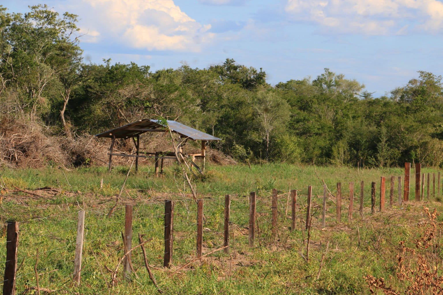
However, granting official protection to Ñembi Guasu doesn’t mean it is free from habitat loss. The National Institute of Agrarian Reform (INRA) authorized 81 rural settlements over the past three years, according to Charagua Iyambae GAIOC data.
Research conducted by the Friends of Nature Foundation (FAN) found that these settlements, exacerbated by climate change, contributed to severe forest fires that damaged 442,186 hectares (1,092,665 acres) in 2019 alone. In 2021, about 200,000 more hectares (494,210 acres) were burned.

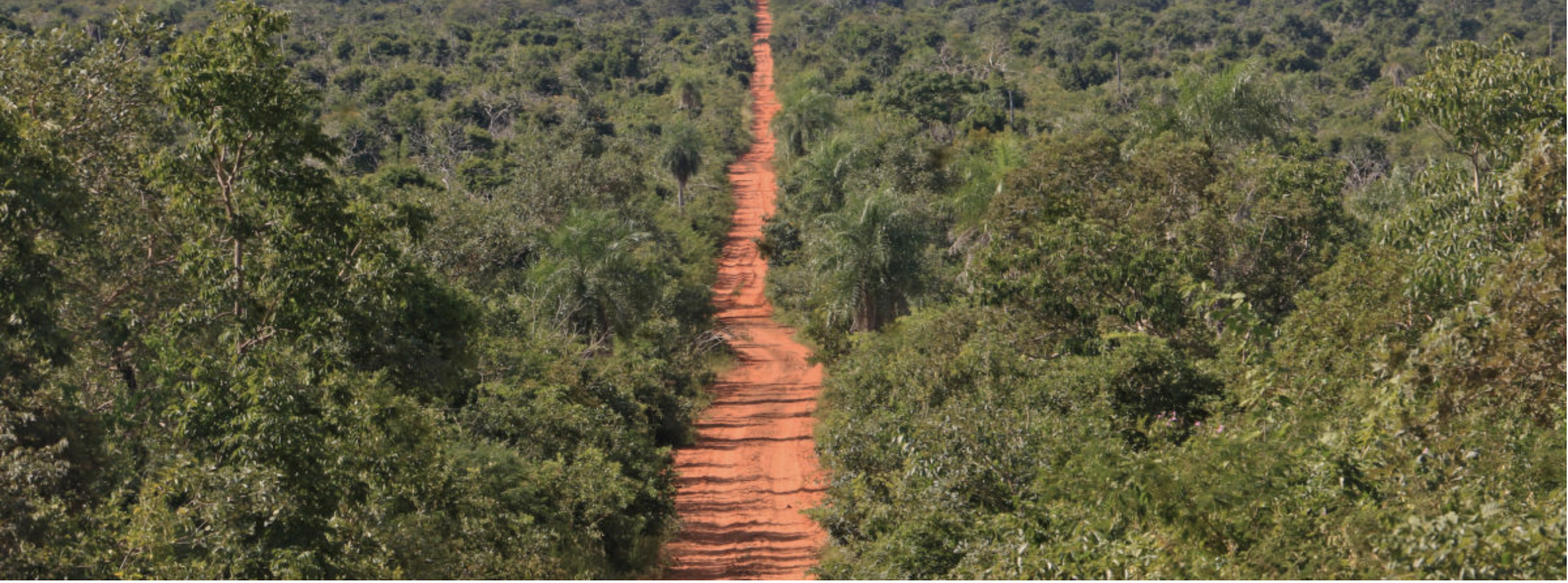
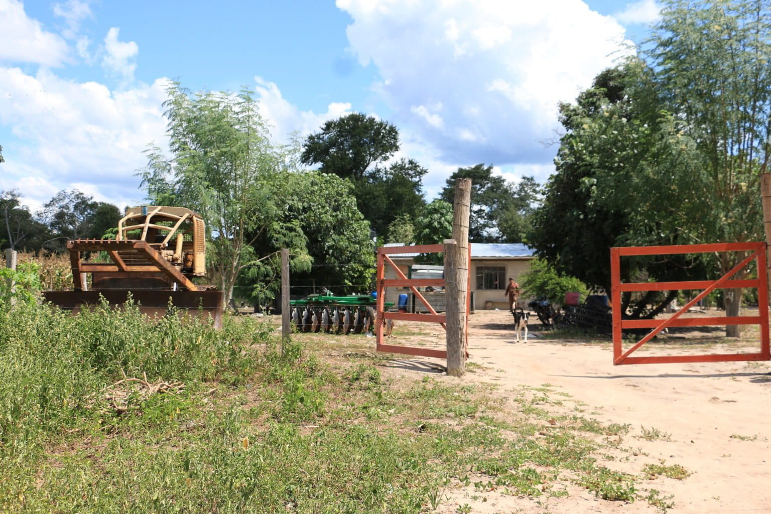
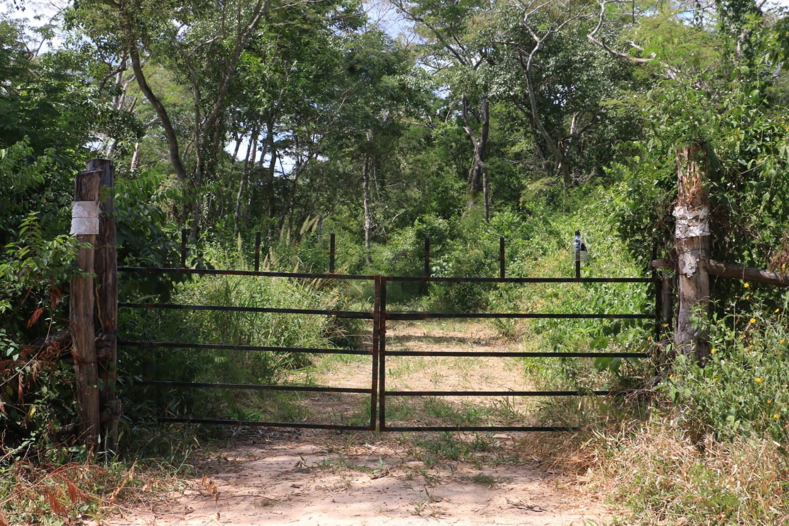
Juan de Dios Garay, a biologist from the organization Nature, Land and Life (Nativa), has been involved in the management of Ñembi Guasu since 2018. Garay says that when he entered the area for the first time, he found cattle ranches and “a ton of [road] signs for rural communities without inhabitants.” A team of reporters made similar observations during an April 2022 trip to Ñembi Guasu; satellite data and imagery visualized on Global Forest Watch show roads and clearings proliferating within Ñembi Guasu over the past several years.
Ravaged by fire


Ñembi Guasu is a dry area, with rainfall amounting to between 400 and 600 millimeters (13.5 and 20.3 fluid ounces) per year (in comparison, the Amazon rainforest receives 1,500 to 3,000 mm [50.7 to 101 fl oz] of rain annually). The San Miguel River and the Aguas Calientes River run through the protected area and act as oases that attract a diverse array of wildlife, including jaguars (Panthera onca). Because of this, Ñembi Guasu serves as an ecological corridor between Kaa-Iya del Gran Chaco National Park and Otuquis National Park.
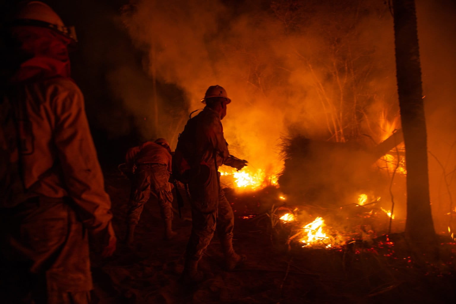
In 2019, unprecedented forest fires raged across some 6.4 million hectares (about 15.8 million acres, roughly the size of West Virginia) of Bolivia. “Ñembi Guasu was the epicenter of the fastest and most intense fires in the world,” says Huáscar Azurduy, director of the conservation and restoration unit of the Foundation for the Conservation of the Chiquitano Forest (FCBC).
“The gusts of wind fueled the fires and provoked a flamethrower effect,” says Daniel Villarroel, assistant manager of ecosystem research and monitoring at FAN. He adds that research conducted by FAN and the Wildlife Conservation Society reveals a tree mortality rate of 70-90%.
NASA satellite data visualized on Global Forest Watch show the area comprising Ñembi Guasu was hit hard again by fire in August 2021.
“If there was any trace of tree species that were saved in 2019, with this fire [in 2021], they would have been totally destroyed,” says Mario Cereze, a fire monitoring technician with the Roboré municipal government. However, early rains coupled with human intervention extinguished the Ñembi Guasu fires in less than two weeks, mitigating the destructive potential of a longer burn.
The areas most affected by the fires in 2019 and 2021 are in the “process of regressive succession,” according to Villarroel. But he cautions that the forest, as it was, may not come back. “The fires would be producing a modification in all the physicochemical characteristics of the soil, which does not guarantee that [the vegetation] that will emerge later will be the same as it was before,” Villarroel says.
The region is experiencing drought in 2022, which has led Cerezo and others to fear another destructive fire season. However, as the 2022 dry season winds down, NASA data show no large burns have affected Ñembi Guasu as of Oct. 17.
Protection in limbo
The fires in Ñembi Guasu caused the Charagua Iyambae GAIOC to file a “preventative environmental action” against the INRA and the Forest and Land Inspection and Social Control Authority (ABT) in 2021 for authorizing clearings and burning in the area. The action was accepted by an agro-environmental court, which arranged for an “ecological pause” in Ñembi Guasu that prioritized habitat regeneration and prohibited further development. The action also allows the National Police to monitor activity in the protected area and enforce regulations.
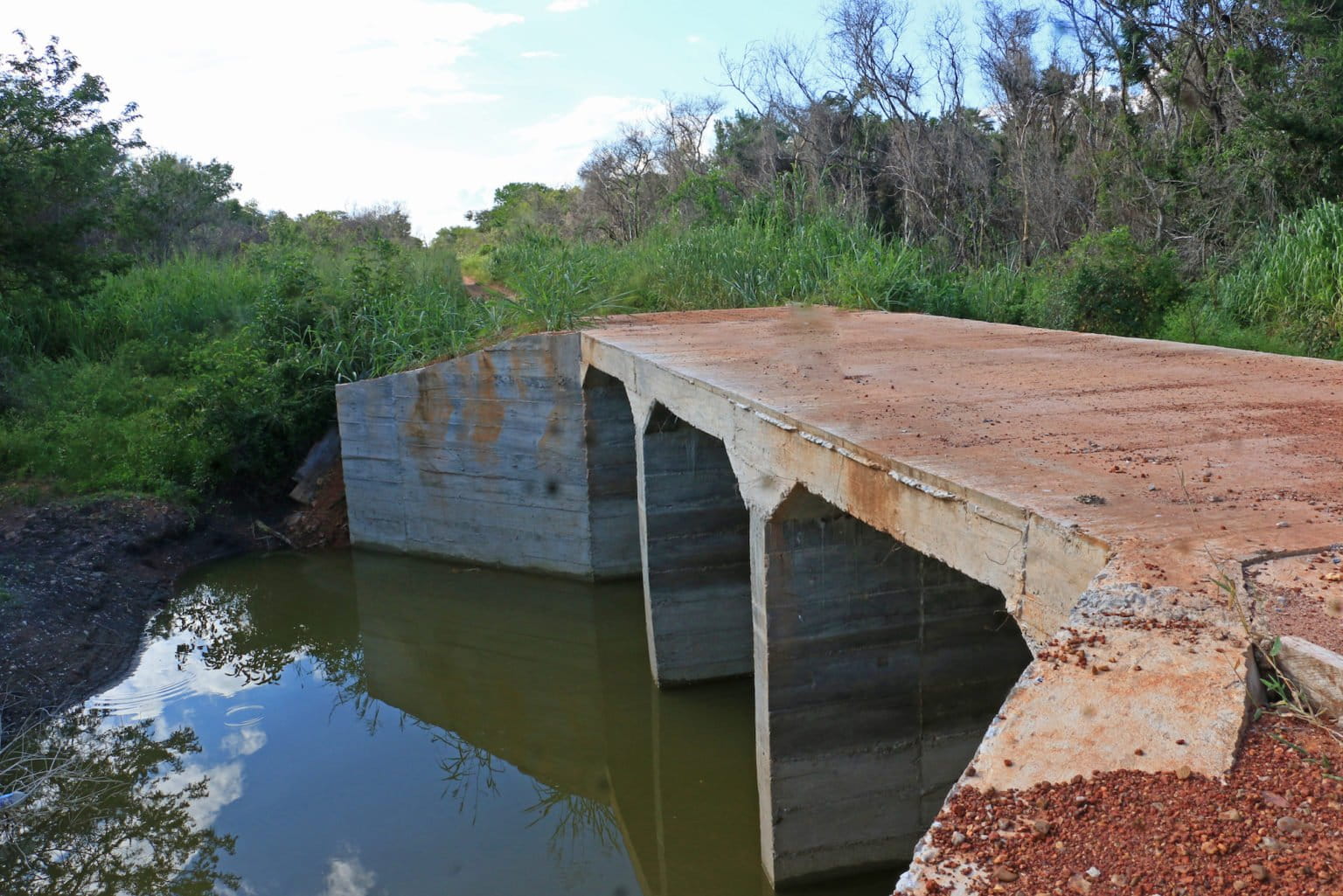
However, sources familiar with Ñembi Guasu say roads are still expanding, and that bridges were built after the preventative environmental action was enacted.
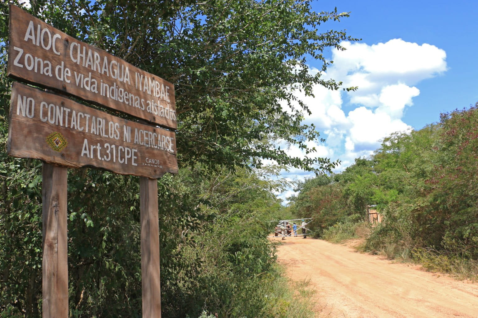
Mongabay reporters visited Ñembi Guasu and observed more than 100 wooden structures along one of the roads inside the protected area. Sources, including Garay who frequently helps patrol the conservation area on behalf of the GAIOC, say they likely belong to rural communities that claim to have land titles.
A resident of one of these communities in Ñembi Guasu, identified only as “Estanislao,” says his employer has owned the land on which the community was built for 10 years, and that the community grows sesame, peanuts, watermelon and other crops.
According to Estanislao, seven communities in the northeastern portion of Ñembi Guasu work with a company called Agroexport headquartered in the Bolivian city of Santa Cruz. “[Agroexport] buys the sesame and is now interested in joco [Bolivian squash] seed to extract its oil,” Estanislao says.
José Luis Ojopi, a warehouse manager at Agroexport, denies doing business in Ñembi Guasu.
“We do not monitor planting, except those [producers] who have a direct relationship with the company, and we do not have any in the area you are mentioning,” Ojopi says.
Estanislao and other residents of the Ñembi Guasu community visited by Mongabay reporters say they do not permanently occupy the area due to heat, aridity and mosquitos. “Here it doesn’t rain; you have to pay for water,” Estanislao says.
The Charagua Iyambae GAIOC is planning to enact a law to further preserve autonomous protected areas, which will apply to the five areas inhabited by Guaraní communities: Kaa-Iya, Otuquis, Ñembi Guasu, Serranía de Irenda and Guajukaka.
“For this reason, we believe it is very important to have a law [regarding autonomous protected areas], since the area being conserved exceeds 5 million hectares [about 12,355,269 acres],” says José Ávila, the director of the protected areas of the Charagua Iyambae GAIOC. “It will be a Guaraní system that allows for the management of each area. With the law, we will make the regulations, have control, surveillance and tourism.”
The Charagua Iyambae was expecting to enact the law in June 2021. However, this had not yet happened by the time of this article’s publication in Spanish, and authorities from the GAIOC estimate that it will not come to pass this year. “We are in the development process,” Ávila says.
A new road looms
In June 2021, the Paraguayan news outlet ABC reported that producers from the Agua Dulce region of Paraguay, across the border from Ñembi Guasu, are exploring how to unite their region with Bolivia via a road that would be built across the protected area. According to the report, the cross-border talks with Bolivian ranchers are at a “very advanced” stage.
“It is an association of around 70 members from the Paraguayan side, on the border, who have made an alliance with ranchers from the Bolivian side,” says Leonardo Tamburini, the director of the Bolivian legal assistance organization Oré. “On the [Paraguayan] side, there are gigantic clearings.”
In a phone interview, Celso Muxfeldt Echauri, the president of the Agua Dulce Agricultural Association (APAD) of Paraguay, says the road would increase access to Ñembi Guasu and prevent future fires. According to a Paraguayan government document, the project is “of priority and of strategic interest to national interests.”
Muxfeldt says the plan has been in progress since 2015 and has the support of the current mayor of the Bolivian city of Roboré, José Eduardo Díaz.
“With [Díaz], we want to assemble the international meeting in October so that both central governments [view the road project] as a binational agenda,” Muxfeldt says. “We [in Paraguay] already made our route with help from the Ministry of Public Works. We have already finished graveling our section up to the border with Bolivia.”
Mayor Díaz says that what is being sought is “to coordinate and join forces” to prevent and reduce fires, but also “to strengthen [agricultural] production and tourism sectors,” of Roboré.
Ávila says Charagua Iyambae GAIOC has not yet received any official communication regarding the road project but is concerned about impacts to the region if it comes to pass.
“We have offices in Roboré and we believe that the first thing would be to let us know [if the project is] viable because we know that it could generate problems in the future,” Ávila says.
This is a translated and adapted version of a story that was first reported by Mongabay’s Latam team and published here on our Latam site on July 8, 2022.
Citation:
Impactos Ecológicos de los Incendios sobre la Amazonía, Bosque Seco Chiquitano y el Pantanal boliviano. (2021). Retrieved from Fundación Amigos de la Naturaleza website: https://www.fan-bo.org/wp-content/uploads/2021/07/Informe-Tecnico_Restauracion_FAN2021.pdf
El área protegida que no es: el Ñembi Guasu de Bolivia acosado por incendios, fincas, caminos
por Rocío Lloret, 17 de Octubre 2022
- El Área de Conservación e Importancia Ecológica Ñembi Guasu es la segunda área protegida más grande en la ecorregión Gran Chaco del sur de Bolivia, y un área importante para las comunidades indígenas.
- A pesar de obtener el reconocimiento oficial como área protegida en 2019, en los últimos tres años han aparecido decenas de asentamientos rurales en Ñembi Guasu.
- Las investigaciones indican que estos asentamientos contribuyeron a incendios forestales graves en 2019 y 2021; los datos e imágenes satelitales muestran la proliferación de caminos y claros dentro de Ñembi Guasu durante los últimos años.
- Mientras tanto, las autoridades están planificando otra vía que atravesaría Ñembi Guasu con el fin de conectar a los productores agrícolas de Bolivia y Paraguay.
Este reportaje es parte de una colaboración periodística entre Mongabay Latam, La Región y Red Ambiental de Información.
ROBORÉ, Bolivia—El pueblo guaraní del Chaco boliviano se refiere a la región de Ñembi Guasu como el “gran refugio”. En reconocimiento a su importancia ecológica y social, el Gobierno Autónomo Indígena Rural Charagua Iyambae (GAIOC) la incorporó como área protegida en 2014 como Área de Conservación e Importancia Ecológica Nación Guaraní Ñembi Guasu. En 2019, el gobierno boliviano reconoció oficialmente a Ñembi Guasu. Con 1.207.850 hectáreas (2.984.662 acres), es la segunda área protegida más grande del Gran Chaco, que es una ecorregión semiárida que se extiende por gran parte de Bolivia, Paraguay y Argentina.
“[El hecho] de que —en su estatuto de autonomía— los guaraníes hayan incluido un área de conservación es un elemento que diferencia a Ñembi Guasu de otras áreas protegidas. Es una demanda histórica y cultural, no solo ambiental, que es, en general, el motivo para crear un área protegida”, dice Leonardo Tamburini, director de Oré, una organización que brinda asistencia legal a las comunidades indígenas en Bolivia.
Sin embargo, otorgar protección oficial a Ñembi Guasu no significa que esté libre de pérdida de hábitat. El Instituto Nacional de Reforma Agraria (INRA) autorizó 81 asentamientos rurales en los últimos tres años, según datos de Charagua Iyambae GAIOC.
Una investigación realizada por la Fundación Amigos de la Naturaleza (FAN) encontró que estos asentamientos, exacerbados por el cambio climático, contribuyeron a incendios forestales severos que dañaron 442,186 hectáreas (1,092,665 acres) solo en 2019. En 2021, se quemaron unas 200.000 hectáreas más (494.210 acres).
Juan de Dios Garay, biólogo de la organización Naturaleza, Tierra y Vida (Nativa), ha estado involucrado en el manejo de Ñembi Guasu desde 2018. Garay dice que cuando ingresó a la zona por primera vez, encontró ranchos ganaderos y “ una tonelada de señales [carreteras] para comunidades rurales sin habitantes”. Un equipo de reporteros hizo observaciones similares durante un viaje de abril de 2022 a Ñembi Guasu; Los datos satelitales y las imágenes visualizadas en Global Forest Watch muestran la proliferación de caminos y claros dentro de Ñembi Guasu en los últimos años.
Devastado por el fuego
Ñembi Guasu es una zona seca, con precipitaciones de entre 400 y 600 milímetros (13,5 y 20,3 onzas líquidas) al año (en comparación, la selva amazónica recibe de 1500 a 3000 mm [50,7 a 101 onzas líquidas] de lluvia al año). El río San Miguel y el río Aguas Calientes atraviesan el área protegida y actúan como oasis que atraen una gran variedad de vida silvestre, incluidos los jaguares (Panthera onca). Por ello, Ñembi Guasu sirve como corredor ecológico entre el Parque Nacional Kaa-Iya del Gran Chaco y el Parque Nacional Otuquis.
En 2019, incendios forestales sin precedentes arrasaron unos 6,4 millones de hectáreas (alrededor de 15,8 millones de acres, aproximadamente el tamaño de Virginia Occidental) de Bolivia. “Ñembi Guasu fue el epicentro de los incendios más rápidos e intensos del mundo”, dice Huáscar Azurduy, director de la unidad de conservación y restauración de la Fundación para la Conservación del Bosque Chiquitano (FCBC).
“Las ráfagas de viento alimentaron los incendios y provocaron un efecto lanzallamas”, dice Daniel Villarroel, subgerente de investigación y monitoreo de ecosistemas de FAN. Agrega que la investigación realizada por FAN y la Sociedad de Conservación de la Vida Silvestre revela una tasa de mortalidad de árboles del 70-90%.
Los datos satelitales de la NASA visualized on Global Forest Watch muestran que el área que comprende Ñembi Guasu fue golpeada nuevamente por un incendio en agosto de 2021.
“Si hubiera quedado algún rastro de las especies de árboles que se salvaron en 2019, con este incendio [en 2021], se habrían destruido por completo”, dice Mario Cereze, técnico de monitoreo de incendios del gobierno municipal de Roboré. Sin embargo, las lluvias tempranas junto con la intervención humana extinguieron los incendios de Ñembi Guasu en menos de dos semanas, mitigando el potencial destructivo de una quema más prolongada.
Las zonas más afectadas por los incendios en 2019 y 2021 se encuentran en “proceso de sucesión regresiva”, según Villarroel. Pero advierte que el bosque, tal como era, puede no volver. “Los incendios estarían produciendo una modificación en todas las características fisicoquímicas del suelo, lo que no garantiza que [la vegetación] que surgirá después sea la misma que era antes”, dice Villarroel.
La región está experimentando una sequía en 2022, lo que ha llevado a Cerezo y a otros a temer otra temporada de incendios destructiva. Sin embargo, a medida que termina la estación seca de 2022, los datos de la NASA muestran que hasta el 17 de octubre no se han producido grandes quemaduras en Ñembi Guasu.
Protección en el limbo
Los incendios en Ñembi Guasu provocaron que la GAIOC de Charagua Iyambae interpusiera una “acción ambiental preventiva” contra el INRA y la Autoridad de Fiscalización y Control Social (ABT) de Tierras y Bosques en 2021 por autorizar desmontes y quemas en la zona. La acción fue aceptada por un tribunal agroambiental, que dispuso una “pausa ecológica” en Ñembi Guasu que priorizó la regeneración del hábitat y prohibió un mayor desarrollo. La acción también permite a la Policía Nacional monitorear la actividad en el área protegida y hacer cumplir las normas.
Sin embargo, fuentes familiarizadas con Ñembi Guasu dicen que las carreteras aún se están ampliando y que los puentes se construyeron después de que se promulgó la acción ambiental preventiva.
Reporteros de Mongabay visitaron Ñembi Guasu y observaron más de 100 estructuras de madera a lo largo de uno de los caminos dentro del área protegida. Las fuentes, incluido Garay, que con frecuencia ayuda a patrullar el área de conservación en nombre del GAIOC, dicen que probablemente pertenecen a comunidades rurales que afirman tener títulos de propiedad.
Un habitante de una de estas comunidades en Ñembi Guasu, identificado solo como “Estanislao”, dice que su empleador es propietario del terreno en el que se construyó la comunidad desde hace 10 años, y que en la comunidad se cultiva ajonjolí, maní, sandía y otros cultivos.
Según Estanislao, siete comunidades en la parte nororiental de Ñembi Guasu trabajan con una empresa llamada Agroexport con sede en la ciudad boliviana de Santa Cruz. “[Agroexport] compra el ajonjolí y ahora está interesada en la semilla de joco [calabaza boliviana] para extraer su aceite”, dice Estanislao.
José Luis Ojopi, encargado de almacén de Agroexport, niega hacer negocios en Ñembi Guasu.
“Nosotros no monitoreamos las siembras, excepto aquellos [productores] que tienen una relación directa con la empresa, y no tenemos ninguno en la zona que mencionas”, dice Ojopi.
Estanislao y otros residentes de la comunidad de Ñembi Guasu visitados por los reporteros de Mongabay dicen que no ocupan permanentemente el área debido al calor, la aridez y los mosquitos. “Aquí no llueve; hay que pagar por el agua”, dice Estanislao.
El GAIOC Charagua Iyambae tiene previsto promulgar una ley para preservar aún más las áreas protegidas autónomas, que se aplicará a las cinco áreas habitadas por comunidades guaraníes: Kaa-Iya, Otuquis, Ñembi Guasu, Serranía de Irenda y Guajukaka.
“Por eso creemos que es muy importante tener una ley [sobre áreas protegidas autónomas], ya que el área que se está conservando supera los 5 millones de hectáreas [unas 12.355.269 acres]”, dice José Ávila, director de áreas protegidas de la Charagua Iyambae GAIOC. “Será un sistema guaraní que permita la gestión de cada área. Con la ley vamos a hacer los reglamentos, tener control, vigilancia y turismo”.
El Charagua Iyambae esperaba promulgar la ley en junio de 2021. Sin embargo, esto aún no había sucedido al momento de la publicación de este artículo en español, y las autoridades del GAIOC estiman que no sucederá este año. “Estamos en proceso de desarrollo”, dice Ávila.
Un nuevo camino se avecina
En junio de 2021, el medio de noticias paraguayo ABC informó que los productores de la región de Agua Dulce de Paraguay, al otro lado de la frontera con Ñembi Guasu, están explorando cómo unir su región con Bolivia a través de una carretera que se construiría a través del área protegida. Según el informe, las conversaciones transfronterizas con los ganaderos bolivianos se encuentran en una etapa “muy avanzada”.
“Es una asociación de alrededor de 70 miembros del lado paraguayo, en la frontera, que han hecho una alianza con ganaderos del lado boliviano”, dice Leonardo Tamburini, director de la organización boliviana de asistencia legal Oré. “Del lado [paraguayo] hay claros gigantes”.
En una entrevista telefónica, Celso Muxfeldt Echauri, presidente de la Asociación Agropecuaria Agua Dulce (APAD) de Paraguay, dice que la carretera aumentaría el acceso a Ñembi Guasu y evitaría futuros incendios. Según un documento, del gobierno paraguayo, el proyecto es “de prioridad y de interés estratégico para los intereses nacionales”.
Muxfeldt dice que el plan ha estado en marcha desde 2015 y cuenta con el apoyo del actual alcalde de la ciudad boliviana de Roboré, José Eduardo Díaz.
“Con [Díaz] queremos armar la reunión internacional en octubre para que ambos gobiernos centrales [vean el proyecto vial] como una agenda binacional”, dice Muxfeldt. “Nosotros [en Paraguay] ya hicimos nuestra ruta con ayuda del Ministerio de Obras Públicas. Ya hemos terminado de gravar nuestro tramo hasta la frontera con Bolivia”.
El alcalde Díaz dice que lo que se busca es “coordinar y aunar esfuerzos” para prevenir y reducir los incendios, pero también “fortalecer los sectores productivos y turísticos”, de Roboré.
Ávila dice que Charagua Iyambae GAIOC aún no ha recibido ninguna comunicación oficial sobre el proyecto vial, pero está preocupado por los impactos en la región si se lleva a cabo.
“Tenemos oficinas en Roboré y creemos que lo primero sería avisarnos [si el proyecto es] viable porque sabemos que puede generar problemas en el futuro”, dice Ávila.
Esta es una versión traducida y adaptada de una historia que fue reportada por primera vez por el equipo de Latam de Mongabay y publicada aquí en nuestro Latam site en Julio 8, 2022.
Citación:
Impactos Ecológicos de los Incendios sobre la Amazonía, Bosque Seco Chiquitano y el Pantanal boliviano. (2021). Obtenido del sitio web de la Fundación Amigos de la Naturaleza: https://www.fan-bo.org/wp-content/uploads/2021/07/Informe-Tecnico_Restauracion_FAN2021.pdf
